
THE STORY
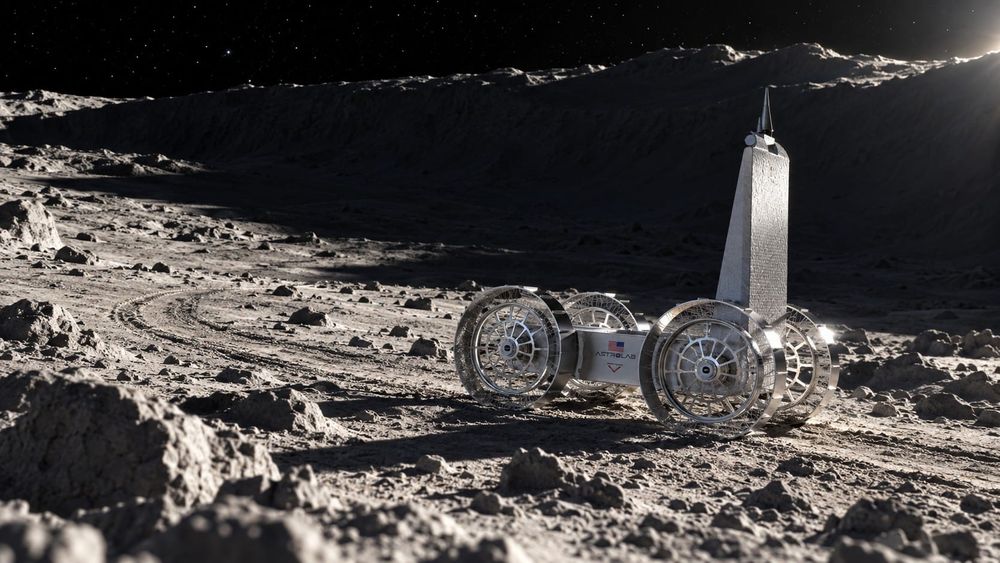
Astrolab and Interstellar Mapping have disclosed a partnership to help the FLIP rover choose where to take measurements during its planned lunar water search. The companies confirmed the arrangement to Payload in reporting dated September 22–23. Interstellar Mapping will use subsurface analysis to guide the search toward locations where water and other hydrogen-bearing volatiles could persist. This is a targeting development ahead of a mission: the supplied evidence establishes neither a water discovery nor a completed lunar deployment.
The interesting detail is how the partnership approaches the terrain. Interstellar Mapping CEO Andrew Hazelton explains that selecting only the coldest or darkest locations is insufficient; subsurface thermal conditions also matter when evaluating where volatile materials could remain. Volatiles are materials that can escape as vapor under suitable conditions. The proposed analysis therefore asks a more specific question than whether a patch of lunar ground looks promising from above: what do its thermal conditions suggest about material beneath it? For FLIP, the intended practical output is guidance on where to measure. That distinction matters because a useful prediction becomes scientifically valuable only when observations can test it.
Interstellar Mapping describes converting orbital and surface observations into mission-specific datasets for resource identification, rover routing, hazard avoidance and infrastructure-site selection. An ESA Technology Broker profile describes its thermal map as covering more than 400 million lunar points at 2.5-hour intervals over a lunar year. That is a provider-described mapping capability, not a demonstrated water-detection accuracy. The partnership report supplies no target coordinates, depth sensitivity, accuracy validation or named water-measurement instrument. Those omissions prevent a stronger claim about what FLIP will detect, but they also identify the evidence needed to judge whether the targeting approach works.
Payload reports a planned November launch with Astrobotic’s Griffin-1 lander for an attempted lunar south-pole landing under NASA’s Commercial Lunar Payload Services initiative. Astrolab’s May announcement independently identifies Griffin-1 as FLIP’s ride and gives the broader window of late 2026. It describes FLIP as a small-payload delivery and autonomous surface-mobility platform approaching its lunar debut. If the mission reaches the surface and returns suitable measurements, this partnership could connect a subsurface prediction to a rover’s actual sampling decisions—a meaningful step toward learning which lunar resource maps deserve operational trust.
THE DOUGH
If the approach improves measurement targeting, mission-specific mapping could become a service purchased alongside rover operations and payload delivery. Potential demand could extend to route planning and infrastructure-site assessment, capabilities Interstellar Mapping already describes offering. No contract value or recoverable resource estimate is supplied, so this partnership supports a prospective data-services opportunity rather than a demonstrated lunar extraction business.
We are not financial analysts or investment advisors. Nothing in this newsletter constitutes investment advice. All economic analysis is speculative and for informational purposes only. Do your own research.
THE POSSIBILITIES
A useful outcome could include discovering where the model is wrong: measurements that contradict predicted retention conditions could help improve subsequent targeting. If those comparisons become available, a single rover mission could contribute to the quality of planning data used by later missions.
THE HURDLES
FLIP must first reach the lunar surface, and the reported November launch remains a plan. Even successful identification of hydrogen-bearing material would not by itself establish recoverable water reserves; instrument details, measurement validation and resource characterization remain essential unknowns.
WHAT TO WATCH
- Updated Griffin-1 and FLIP launch and landing schedules.
- Identification of the instrument and measurements intended to test the water-search predictions.
- Disclosure of target-selection methods, depth sensitivity and validation criteria.
- Surface results compared with the mapping team’s pre-mission predictions.
Void Economy is researched, written, and illustrated with AI, reviewed and edited by a real, live, flesh-n-blood human.